Site Detail
This page covers one Site: its location, the external environmental data it collects, and the Deployments anchored to it.
Site Information
The information card is the summary of the Site. It shows the Site name and description, a copyable ID, its coordinates and the number of Deployments anchored to it, icons for the environmental data it subscribes to, and a map of its anchor location.
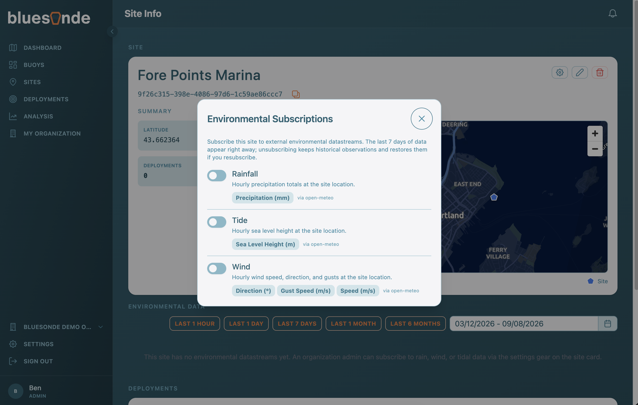
The card is also where you manage the Site. If you are an Organization Admin, you can rename the Site and edit its description, open the environmental subscriptions to choose which Datastreams it collects, which is covered in the next section, and delete the Site. A Site cannot be deleted while Deployments are still anchored to it. Note that the anchor location is fixed when the Site is created and cannot be moved afterward.
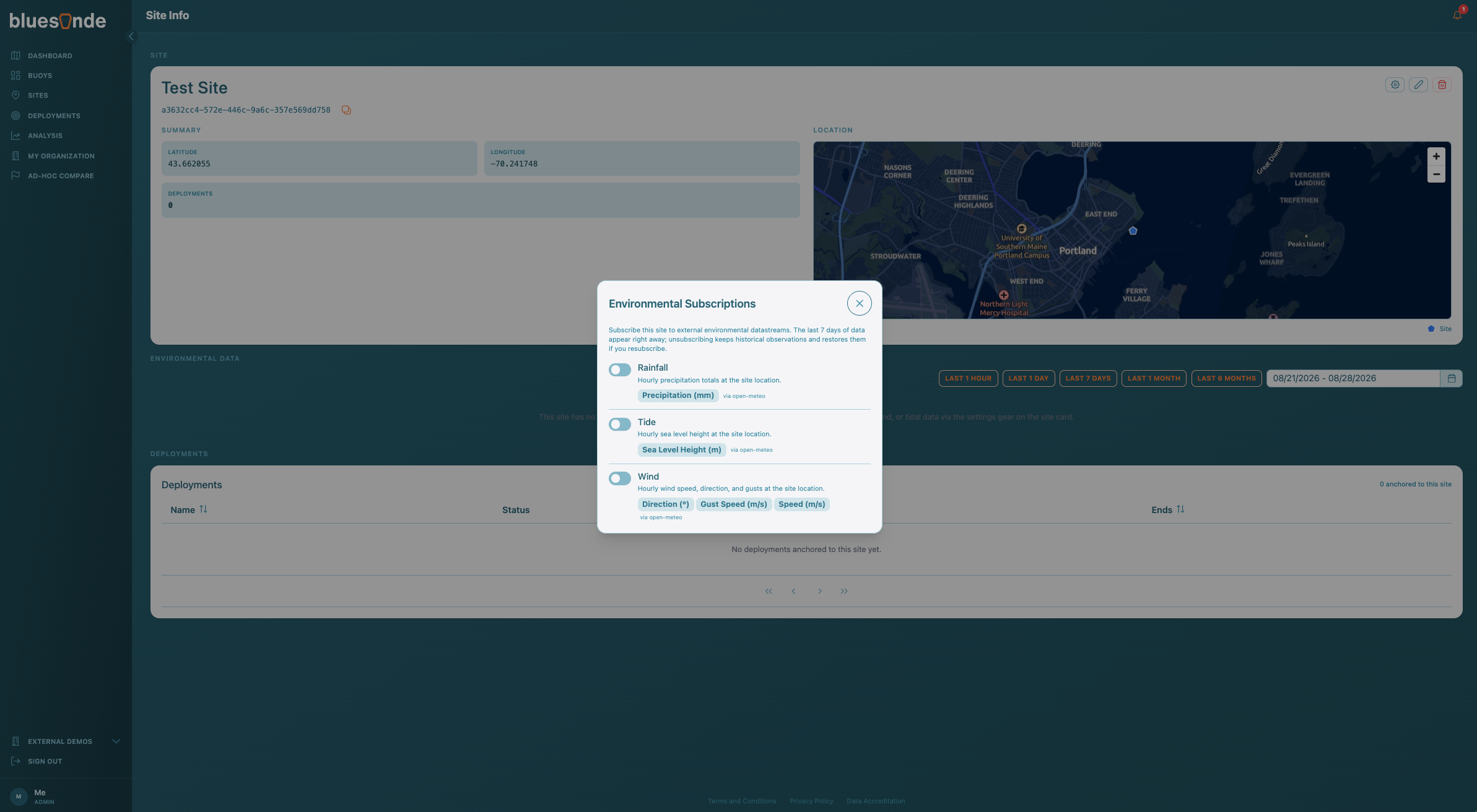
Environmental Data
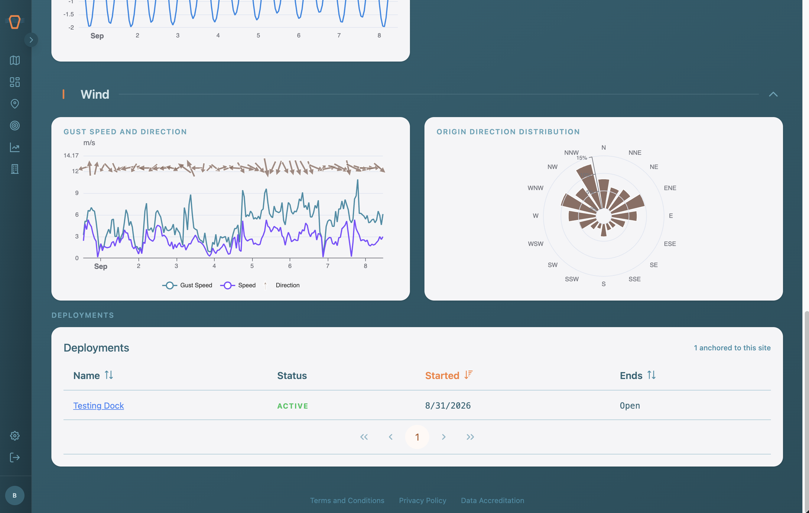
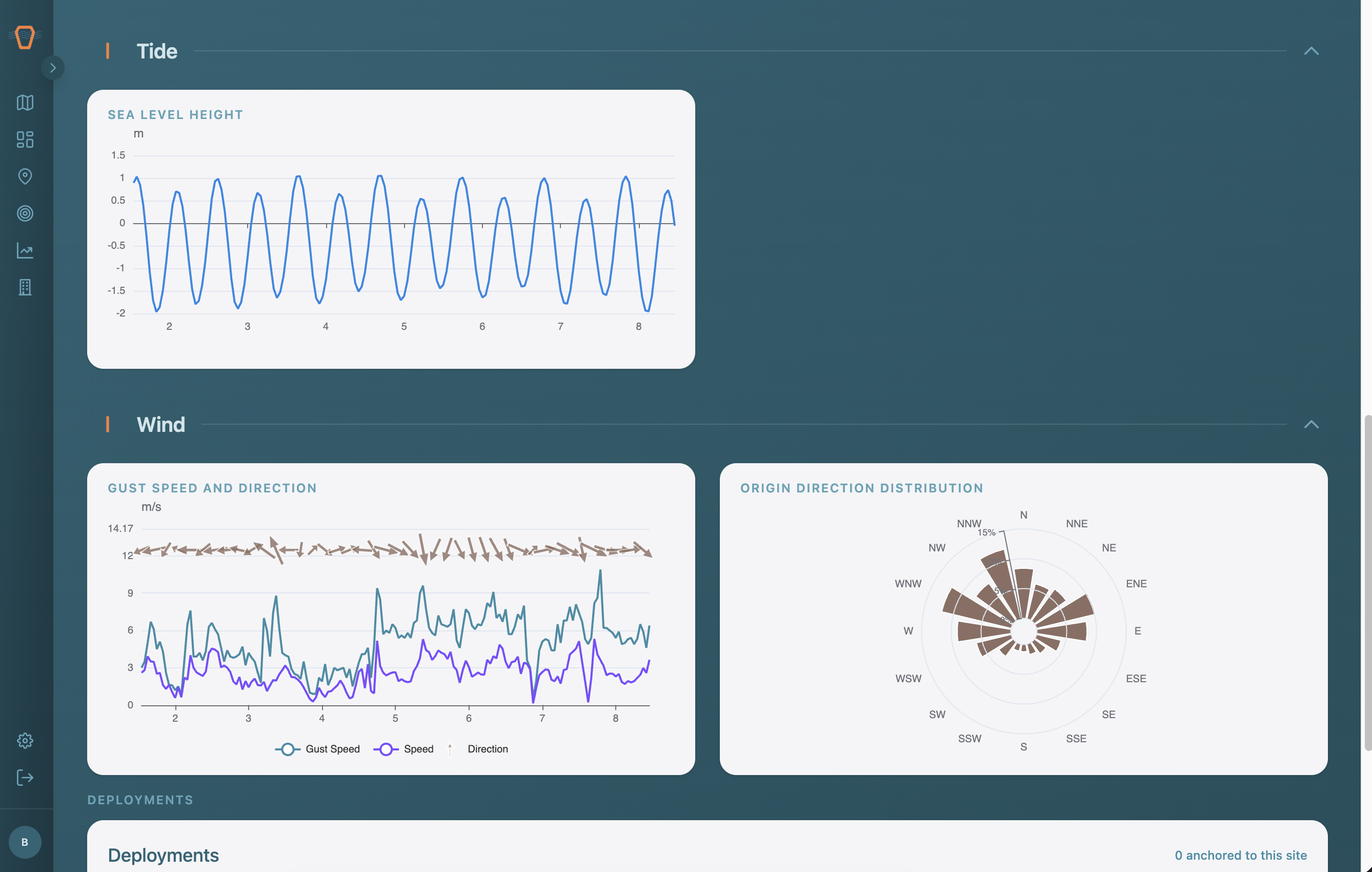
A Site can subscribe to external Datastreams such as rain, wind, and tide. Open the subscriptions settings to turn these on or off. Use the date range selector to choose a window, and the charts below plot each Datastream over that time. If data is missing for the window you pick, a prompt lets you backfill it.
Anchored Deployments
At the bottom, a table lists the Deployments anchored to this Site, with links to each one.